Charts & Maps
Showing 31–60 of 106 results
-
 Accesories, Charts & Maps, Fishing
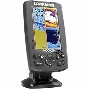
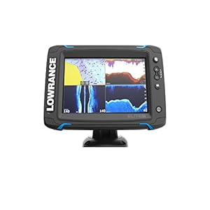
Lowrance Hook-4 Sonar/GPS Mid/High/Downscan Fishfinder
High-resolution, 4 inch color display
CHIRP sonar plus downscan imaging the power of today’s leading fish finder technologies combined to provide the best possible view beneath boat
Downscan overlay Technology Overlays downscan imaging onto chirp sonar -
 Accesories, Charts & Maps, Fishing
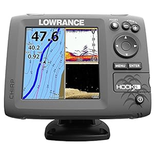
Lowrance Hook-5 Sonar/GPS Mid/High/Downscan Fishfinder
High-resolution, 5 inch color display
CHIRP sonar plus downscan imaging the power of today’s leading fish finder technologies combined to provide the best possible view beneath boat
Highly accurate, built-in GPS antenna plus detailed U.S. Map featuring more than 3,000 lakes, rivers & costal contours to 1,000ft -
 Accesories, Charts & Maps, Fishing
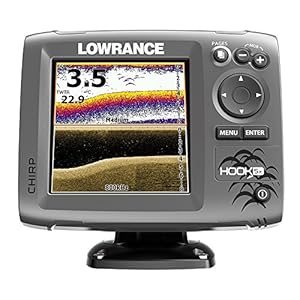
Lowrance Hook-5 Sonar/GPS Mid/High/Downscan Navionics+ Fishf...
High-resolution, 5 inch color display
CHIRP sonar plus downscan imaging the power of today’s leading fish finder technologies combined to provide the best possible view beneath boat
Highly accurate, built-in GPS antenna plus detailed U.S. Map featuring more than 3,000 lakes, rivers & costal contours to 1,000ft -
 Accesories, Charts & Maps, Fishing
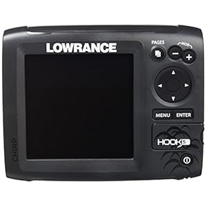
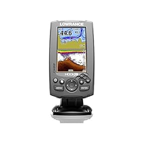
Lowrance Hook-5X Sonar Mid/High/Downscan Fishfinder
High-resolution, 5 inch color display
CHIRP sonar plus downscan imaging the power of today’s leading fish finder technologies combined to provide the best possible view beneath boat
Downscan overlay Technology Overlays downscan imaging onto chirp sonar -
 Accesories, Charts & Maps, Fishing
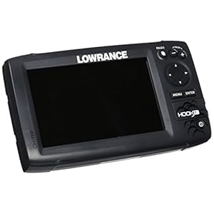
Lowrance Hook-7 Base Sonar/GPS Mid/High/Downscan Fishfinder
High-resolution, 7 inch color display
CHIRP sonar plus downscan imaging the power of today’s leading fish finder technologies combined to provide the best possible view beneath boat
Highly accurate, built-in GPS antenna plus detailed U.S. Map featuring more than 3,000 lakes, rivers & costal contours to 1,000ft -
 Accesories, Charts & Maps, Fishing
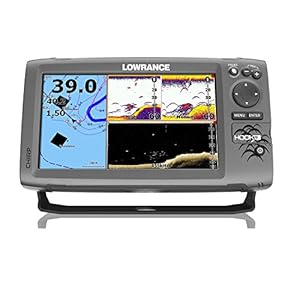
Lowrance Hook-9 Sonar/GPS Mid/High/Downscan Fishfinder
High-resolution, 9 inch color display
CHIRP sonar plus downscan imaging the power of today’s leading fish finder technologies combined to provide the best possible view beneath boat
Highly accurate, built-in GPS antenna plus detailed U.S. Map featuring more than 3,000 lakes, rivers & costal contours to 1,000ft -
 Accesories, Charts & Maps, Fishing
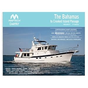
Maptech ChartKit Region 9: The Bahamas to Crooked Island Pas...
A Great Value You’ll save up to 90% compared to the cost of purchasing individual government charts.
The Perfect Size Large enough to plot routes; small enough to fit on your lap.
Easy to Use Pre-plotted waypoints and lat/long grids for your GPS; magnetic courses for your compass. -
 Accesories, Charts & Maps, Fishing
Navionics HotMaps Platinum North Lake Charts on SD/MSD
Max detailed charts for cruising, fishing and sailing, plus 3D View, satellite overlay and panoramic port photos all in one.
Includes SonarChartTM 1 foot HD bathymetry map that reflects ever changing conditions, and Community Edits, valuable local information added by millions of Navionics Boating app users.
Get the most current charts every day with daily updates for one year. -
 Accesories, Charts & Maps, Fishing
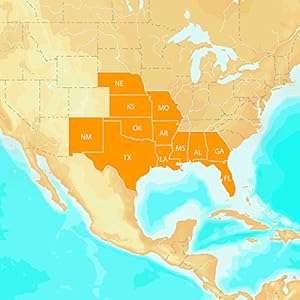
Navionics HotMaps Platinum South U.S. Multi-Dimensional Lake...
Max detailed charts for cruising, fishing and sailing, plus 3D View, satellite overlay and panoramic photos all in one!
Includes Nautical Chart, a robust chart resource trusted by boaters worldwide, SonarChartTM 1 ft HD bathymetry map that reflects ever-changing conditions, and Community Edits, valuable local information added by millions of Navionics Boating app users.
Navionics offers the best-selling boating maps in the world. Get the most current charts – every day – with daily updates for one year! -
 Accesories, Charts & Maps, Fishing
Navionics HotMaps Platinum West Lake Charts on SD/MSD
Max detailed charts for cruising, fishing and sailing, plus 3D View, satellite overlay and panoramic port photos all in one.
Includes SonarChartTM 1 foot HD bathymetry map that reflects ever changing conditions, and Community Edits, valuable local information added by millions of Navionics Boating app users.
Get the most current charts every day with daily updates for one year. -
 Accesories, Charts & Maps, Fishing
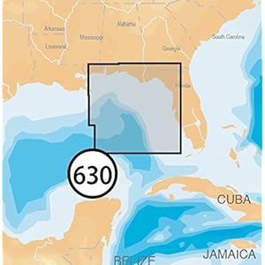
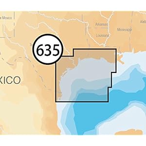
Navionics NAV- Platinum Eastern Gulf of Mexico on SD/microSD...
Max detailed charts for cruising, fishing and sailing, plus 3D View, satellite overlay and panoramic port photos all in one.
Includes SonarChartTM 1 foot HD bathymetry map that reflects ever changing conditions, and downloadable Community Edits, valuable local information added by millions of Navionics Boating app users.
Get the most current charts every day with daily updates for one year. -
 Accesories, Charts & Maps, Fishing
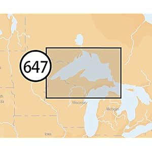
Navionics Platinum Plus 647P+ Lake Superior Marine and Lake ...
Max detailed charts for cruising, fishing and sailing, plus 3D View, satellite overlay and panoramic port photos all in one.
Includes SonarChartTM 1 foot HD bathymetry map that reflects ever changing conditions, and Community Edits, valuable local information added by millions of Navionics Boating app users.
Get the most current charts every day with daily updates for one year. -
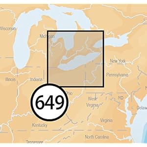 Accesories, Charts & Maps, Fishing
Navionics Platinum Plus 649P+ Lake Erie and Saint Clair Mari...
Max detailed charts for cruising, fishing and sailing, plus 3D View, satellite overlay and panoramic port photos all in one.
Includes Nautical Chart, a robust chart resource trusted by boaters worldwide,SonarChartTM 1 foot HD bathymetry map that reflects ever changing conditions, and Community Edits, valuable local information added by millions of Navionics Boating app users.
Navionics offers the best selling boating maps in the world. Get the most current charts every day with daily updates for one year. -
 Accesories, Charts & Maps, Fishing
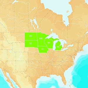
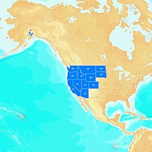
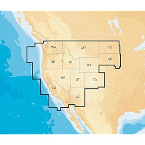
Navionics Plus Regions West Marine and Lake Charts on SD/MSD...
Max detailed charts for cruising, fishing and sailing.
Get full marine coverage and Canadian waters of Puget Sound plus more than 2,600 lakes in AZ, CA, CO, ID, MT, ND, NV, OR, SD, UT, WA and WY.
Includes SonarChartTM 1 foot HD bathymetry map that reflects ever changing conditions, and Community Edits, valuable local information added by millions of Navionics Boating app users. -
 Accesories, Charts & Maps, Fishing
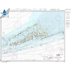
NOAA Chart 11442: Florida Keys Sombrero Key to Sand Key, 35....
ONLY CHARTS SOLD BY RUDY AND RUBY’S BOOKS ON THIS LISTING ARE GUARANTEED TO BE AUTHORIZED FOR CARRIAGE *
Printed on high quality waterproof and tear-resistant material by NOAA Chart Agent, Paradise Cay Publications
Always printed on demand using the most recent data from NOAA -
 Accesories, Charts & Maps, Fishing
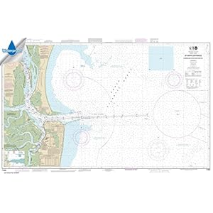
NOAA Chart 11503: St. Marys Entrance Cumberland Sound and Ki...
ONLY CHARTS SOLD BY RUDY AND RUBY’S BOOKS ON THIS LISTING ARE GUARANTEED TO BE AUTHORIZED FOR CARRIAGE *
Printed on high quality waterproof and tear-resistant material by NOAA Chart Agent, Paradise Cay Publications
Always printed on demand using the most recent data from NOAA -
 Accesories, Charts & Maps, Fishing
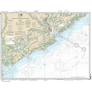
NOAA Chart 11521: Charleston Harbor and Approaches, 34.6 X 4...
ONLY CHARTS SOLD BY RUDY AND RUBY’S BOOKS ON THIS LISTING ARE GUARANTEED TO BE AUTHORIZED FOR CARRIAGE *
Printed on high quality water-resistant paper by NOAA Chart Agent, Paradise Cay Publications
Always printed on demand using the most recent data from NOAA


-
Accesories, Charts & Maps, Fishing
Lowrance StructureScan 3D Module Fishfinder
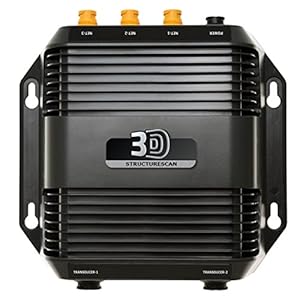
$609.27$609.21 Add to cart