Marine GPS Chartplotters
Showing 61–90 of 106 results
-
 Boat Electronics, Boats & Equipment, Fishing, Fishing Watercraft & Trolling Motors, Marine GPS Chartplotters
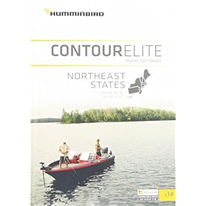
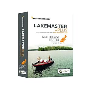
Humminbird Lakemaster Northeast States Contour Map Software,...
I-Pilot link compatible with easy to read contours
Shallow water highlight and also, depth highlight range, water level offset, scrollable lake list
Compatible with Humminbird LakeMaster charts -
 Boat Electronics, Boats & Equipment, Fishing, Fishing Watercraft & Trolling Motors, Marine GPS Chartplotters
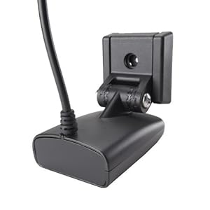
Humminbird XNT 9 SI 180 T Transom Mount Transducer
New design is more secure, less prone to kick up, with improved running angle
Includes 20-foot cable, necessary mounting hardware, and built-in temperature sensor
Combination DualBeam 20- and 60-degree beam sonar, and side-imaging sonar with two 84-degree beams -
 Boat Electronics, Boats & Equipment, Fishing, Fishing Watercraft & Trolling Motors, Marine GPS Chartplotters
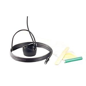
Humminbird XP 9 20 T Puck Transducer
designed to mount to the inside of most fiberglass hulls with a deadrise less than 15 degrees
fiberglass construction and be free of trapped air or voids
meant to be glued to your inner hull with a slow-cure epoxy, which is included -
 Boat Electronics, Boats & Equipment, Fishing, Fishing Watercraft & Trolling Motors, Marine GPS Chartplotters
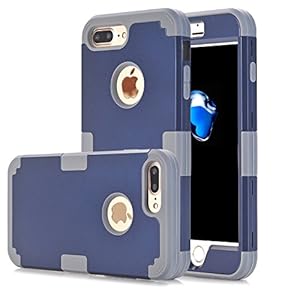
iPhone 7 Plus Case, Asstar Hybrid Heavy Duty Shockproof Hard...
Designed specifically for your precious Apple iPhone 7 Plus 5.5″
3in1 Design: Plastic Back Cover + Plastic Bumper + TPU inner frame Maximum Protect Your phone from Drop and Scratch Protection
Full degree of protection: covers all four corners and includes raised lip to keep the screen from scratching or touching the ground -
 Boat Electronics, Boats & Equipment, Fishing, Fishing Watercraft & Trolling Motors, Marine GPS Chartplotters
iPhone 7 Plus Case,iPhone 7 Plus Cases,Creativecase [Wallet ...
iPhone 7 Plus Case:Card slots provide you to put debit card, credit card or ID card while on the go
iPhone 7 Plus Phone Case Case Full access to user interface, camera, headphone jack, speaker and microphone. Easy to use and install, uninstall
This iPhone 7 Plus Wallet Case High quality material purse fully protects your phone from scratching dropping and dust -
 Boat Electronics, Boats & Equipment, Fishing, Fishing Watercraft & Trolling Motors, Marine GPS Chartplotters
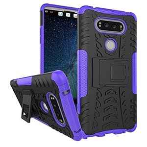
LG V20 Case, Asstar LG V20 Case Cover, Heavy Duty Dual Layer...
LG V20 Case, Compatible with LG V20 (2016).
Kickstand : The build in kickstand can be used in landscape orientation for hands free experience when viewing multimedia, with belt clip holster so you can carry the device wherever you go
PERFECT CUTOUTS: allow you to maximize the functionality of your LG V20 -
 Boat Electronics, Boats & Equipment, Fishing, Fishing Watercraft & Trolling Motors, Marine GPS Chartplotters
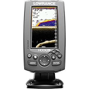
Lowrance 000-12640-001 Hook-4X Sonar W/Mid/Hi XDCR
High-resolution, 4 inch color display
CHIRP sonar plus downscan imaging the power of today’s leading fish finder technologies combined to provide the best possible view beneath boat
Downscan overlay Technology Overlays downscan imaging onto chirp sonar -
Boat Electronics, Boats & Equipment, Fishing, Fishing Watercraft & Trolling Motors, Marine GPS Chartplotters
Lowrance 000-12641-001 Hook-4X Sonar W/Mid/Hi/DownScan XDCR
High-resolution, 4 inch color display
CHIRP sonar plus downscan imaging the power of today’s leading fish finder technologies combined to provide the best possible view beneath boat
Downscan overlay Technology Overlays downscan imaging onto chirp sonar -
 Boat Electronics, Boats & Equipment, Fishing, Fishing Watercraft & Trolling Motors, Marine GPS Chartplotters
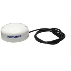
Lowrance Point-1 Baja GPS Antenna with N2K Kit & Compass...
Point-1 GPS antenna, Baja kit
Mfg.# 000-11045-001, GPS/GLONASS receiver with WAAS/egnos/msas & 4′ cable
Nmea 2000-10hz output, and built-in rate-stabilized heading sensor. Includes NMEA 2000 starter kit with 15′ cable, mounting hardware and install guide -
 Boat Electronics, Boats & Equipment, Fishing, Fishing Watercraft & Trolling Motors, Marine GPS Chartplotters
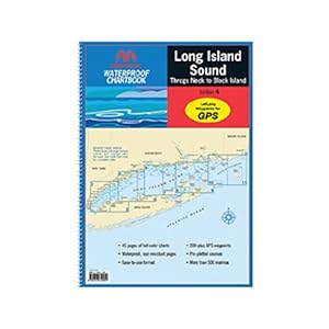
Maptech Long Island Sound WPB032504
Completely updated. Newest edition. 4th edition
Complete coverage of Long Island Sound from Throgs Neck to Block Island and Point Judith
GPS waypoints, Lat./Long. grids, courses, ramps -
 Boat Electronics, Boats & Equipment, Fishing, Fishing Watercraft & Trolling Motors, Marine GPS Chartplotters
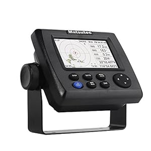
Matsutec HP-33A 4.3″ Color LCD Class B AIS Transponder...
HP-33A is a Ais Transmitter, Also is a marine gps Navigator
Stores up to 10,000 marks/ waypoints, 100 routes and 3,000 track points
This pack includes GPS antenna -
 Boat Electronics, Boats & Equipment, Fishing, Fishing Watercraft & Trolling Motors, Marine GPS Chartplotters
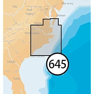
Navionics Platinum Plus 645P+ North Carolina Marine Charts o...
Max detailed charts for cruising, fishing and sailing, plus 3D View, satellite overlay and panoramic port photos all in one.
Includes Nautical Chart, a robust chart resource trusted by boaters worldwide,SonarChartTM 1 foot HD bathymetry map that reflects ever changing conditions, and Community Edits, valuable local information added by millions of Navionics Boating app users.
Navionics offers the best selling boating maps in the world. Get the most current charts every day with daily updates for one year. -
 Boat Electronics, Boats & Equipment, Fishing, Fishing Watercraft & Trolling Motors, Marine GPS Chartplotters
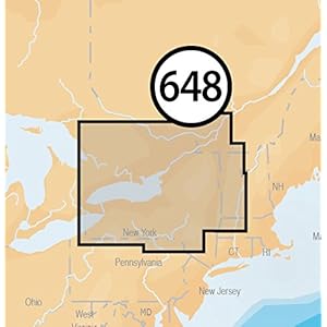
Navionics Platinum Plus 648P+ Lake Ontario Marine and Lake C...
Max detailed charts for cruising, fishing and sailing, plus 3D View, satellite overlay and panoramic port photos all in one.
Includes Nautical Chart, a robust chart resource trusted by boaters worldwide,SonarChartTM 1 foot HD bathymetry map that reflects ever changing conditions, and Community Edits, valuable local information added by millions of Navionics Boating app users.
Navionics offers the best selling boating maps in the world. Get the most current charts every day with daily updates for one year. -
 Boat Electronics, Boats & Equipment, Fishing, Fishing Watercraft & Trolling Motors, Marine GPS Chartplotters
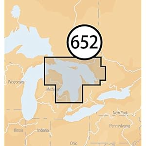
Navionics Platinum Plus 652P+ Lake Huron Marine and Lake Cha...
Max detailed charts for cruising, fishing and sailing, plus 3D View, satellite overlay and panoramic port photos all in one.
Includes SonarChartTM 1 foot HD bathymetry map that reflects ever-changing conditions, and Community Edits, valuable local information added by millions of Navionics Boating app users.
Get the most current charts every day with daily updates for one year. -
 Boat Electronics, Boats & Equipment, Fishing, Fishing Watercraft & Trolling Motors, Marine GPS Chartplotters
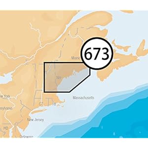
Navionics Platinum Plus 673P+ Maine Marine Charts on SD/MSD
Max detailed charts for cruising, fishing and sailing, plus 3D View, satellite overlay and panoramic port photos all in one
Includes Nautical Chart, a robust chart resource trusted by boaters worldwide,SonarChartTM 1 foot HD bathymetry map that reflects ever changing conditions, and Community Edits, valuable local information added by millions of Navionics Boating app users
Navionics offers the best selling boating maps in the world. Get the most current charts every day with daily updates for one year -
 Boat Electronics, Boats & Equipment, Fishing, Fishing Watercraft & Trolling Motors, Marine GPS Chartplotters
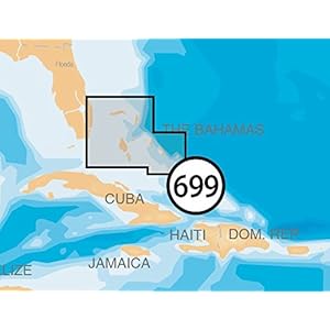
Navionics Platinum Plus 699P+ Northern Bahamas Marine Charts...
Max detailed charts for cruising, fishing and sailing, plus 3D View, satellite overlay and panoramic port photos all in one.
Includes Nautical Chart, a robust chart resource trusted by boaters worldwide,SonarChartTM 1 foot HD bathymetry map that reflects ever changing conditions, and Community Edits, valuable local information added by millions of Navionics Boating app users.
Navionics offers the best selling boating maps in the world. Get the most current charts every day with daily updates for one year. -
 Boat Electronics, Boats & Equipment, Fishing, Fishing Watercraft & Trolling Motors, Marine GPS Chartplotters
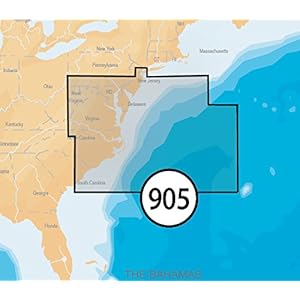
Navionics Platinum+ SD 904 US Ne & Canyons Nautical Char...
Detailed charts for cruising, fishing and sailing, plus 3D View, satellite overlay and panoramic port photos.
Includes SonarChartTM one foot HD bathymetry map and Community Edits, valuable local information added by millions of Navionics Boating app users.
Coverage area includes from Maine, Massachusetts, New York, Hudson River, North Atlantic Canyons from Passamaquoddy Bay and Grand Manan Island to Shark River Inlet, Oneida Lake, The Finger Lakes, Lake Champlain and all of North Atlantic Canyons.